
Project Partners
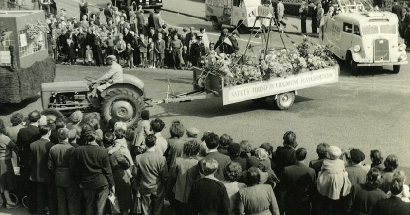
Coronation Carnival 1953 (Courtesy of Historic Barking and Dagenham).
The Layers of London Project is possible through the resources of a range of project partners. These include:
The Institute of Historical Research
The Institute of Historical Research was founded in 1921 and is one of nine institutes that comprise the University of London’s School of Advanced Study. The Institute’s mission is to promote the study of history and an appreciation of the importance of the past among academics and the general public. It offers a wide range of services both onsite and remotely which promote and facilitate excellence in historical research, teaching and scholarship in the UK, by means of its library, events programmes, fellowships, training and publications. It is a leading centre for the creation of digital resources for historians, and promotes the study of London history through its Centre for Metropolitan History and the Victoria County History.
It will be leading the Layers of London project.
Historic England (formerly known as English Heritage), is the public body that champions and protects England’s historic places. It looks after the historic environment, providing expert advice, helping people protect and care for it and helping the public to understand and enjoy it.
Historic England’s contribution to the pilot phase of this project is to provide Royal Airforce aerial photos of Barking and Dagenham taken after WWII showing the extent of damage sustained during the war. For more information about these aerial photos CLICK HERE.
Historic England’s Heritage Schools Programme has created enabled the Layers of London Project to establish links with schools in Barking and Dagenham. Apart from providing valuable input into the development of the project website, it is hoped that schools will contribute to georeferencing the maps and will develop projects that benefit from the website and contribute to it.
The British Library is the national library of the United Kingdom and one of the world’s greatest research libraries. It provides world class information services to the academic, business, research and scientific communities and offers unparalleled access to the world’s largest and most comprehensive research collection. The Library’s collection has developed over 250 years and exceeds 150 million separate items representing every age of written civilisation and includes books, journals, manuscripts, maps, stamps, music, patents, photographs, newspapers and sound recordings in all written and spoken languages. Up to 10 million people visit the British Library website – www.bl.uk – every year where they can view up to 4 million digitised collection items and over 40 million pages.
The British Library will contribute a collection of historic maps to this project, and provides advice on georeferencing the maps. To find out what georeferencing is or to contribute to the Library’s own georeferencing project CLICK HERE.
MOLA (Museum of London Archaeology) provides independent advice and professional services in archaeology and built heritage. With offices in London, Northampton and Birmingham, MOLA’s 250 staff help to discharge planning conditions expertly and swiftly. MOLA works in partnership to develop far-reaching research and community programmes.
MOLA’s contribution to this project includes processing the historic maps contributed by other partners and providing the project with some of their own maps and data.
The National Archives is one of the world’s most valuable resources for research and an independent research organisation in its own right. As the official archive and publisher for the UK government, and England and Wales they are the guardians of some of the UK’s most iconic national documents, dating back over 1,000 years. Their role is to collect and secure the future of the government record, both digital and physical, to preserve it for generations to come, and to make it as accessible and available as possible. The National Archives brings together the skills and specialisms needed to conserve some of the oldest historic documents as well as leading digital archive practices to manage and preserve government information past, present and future.
The National Archives will provide this project with scanned Inland Revenue Survey maps and other valuable sources of information.
London Metropolitan Archives (LMA) is a public research centre which specialises in the history of London. LMA cares for and provides access to the historical archives of businesses, schools, hospitals charities and all manner of other organisations from the London area. The 100 km of books, maps, photographs, films and documents dating back to 1067 in its strong rooms in Clerkenwell form one of the finest city archives in the world – you could call it the memory of London. LMA’s users have a wide range of interests, including family, community and local history, and it provides services to wide variety of researchers including students, artists and architects. It’s an essential destination for anyone interested in the history of London.
LMA’s contributions to this project include providing the London Bomb Maps, showing the damage sustained during the war, and developing and delivering outreach and engagement activities.
The London Borough of Barking and Dagenham Heritage Services
The London Borough of Barking and Dagenham Heritage Services manages sites at Valence House Museum (including the Archive & Local Studies Library) and Eastbury Manor House.
It is planned that oral history projects and other valuable sources of information that are currently being developed by institutions like Eastbury Manor House will form part of the Layers of London website.
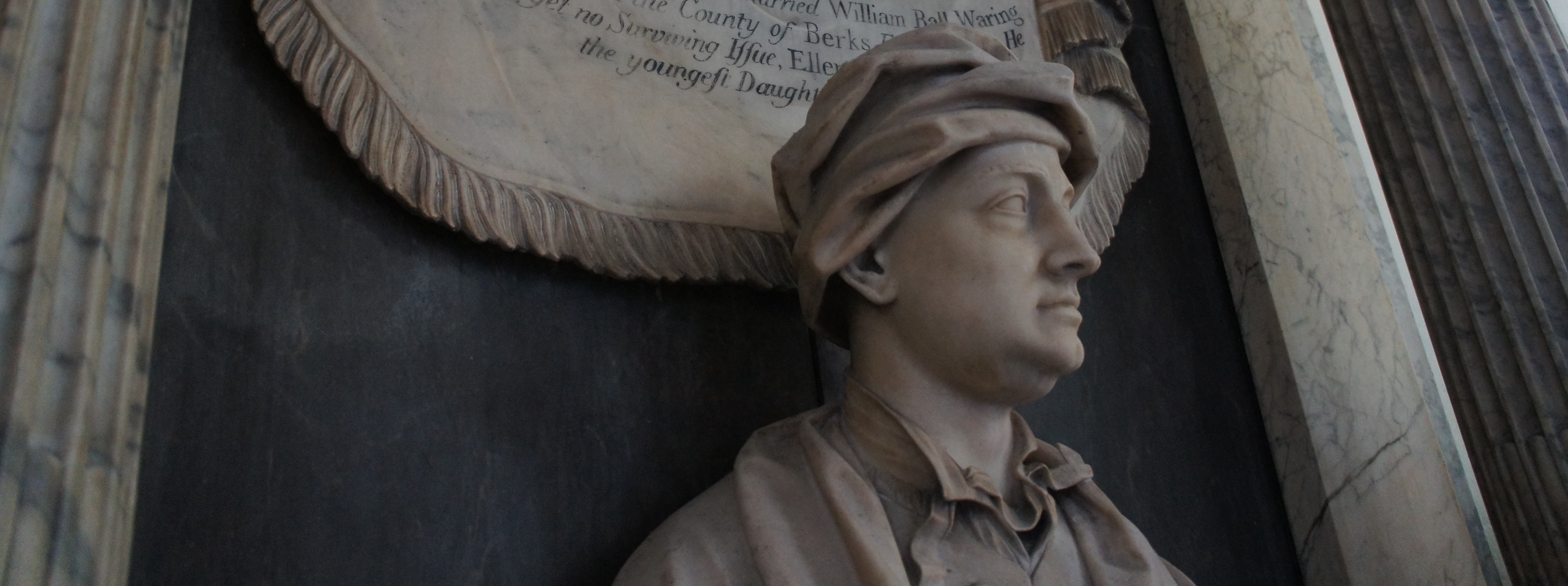
Detail of the memorial of Sir Orlando Humfreys in St Margaret’s Church, Barking. (18th century)